Nevado Copa Norte 6173m - 21 August 2008

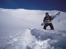
This summit, in the White Mountains of Peru, gave me some bad moments for several reasons. I had to walk for three days to conquer it, ascending over three thousand metres. As there were no huts we had to expend the extra energy entailed in carrying and setting up camp twice. I didn’t have the opportunity to acclimatize as I would have liked to and I experienced altitude sickness for the first time. It took the form of headaches and general discomfort which prevented me from sleeping well. The last section proved to be particularly difficult. I became breathless, so it took me twice as long as it would have done at a lower altitude. I learnt three important things. The first was that you have to acclimatise well to climb big mountains. The second was that you have to take a photo when you see the possibility of a nice shot, even if you feel too lazy to take off the gloves and get the camera out. I lost the chance of a really good photo, with a wonderful mountain landscape, because of that bloody laziness, because, when I took the camera out later, I couldn’t see anything because of the clouds. The last thing I learnt on this trip was that stopping close to the snow bridges that enable you to pass over the glacier crevasses is not a good idea. I saw one of them fall very noisily, just two metres away from me. I got a serious fright, but it was an important lesson and I lived to tell the tale. The photo was taken on August 19th, 2008, two days before reaching the summit. The descent isn´t done along that big wall but along the slope you can see on the left.

Esta cumbre de la Cordillera Blanca peruana sí me lo hizo pasar mal por varios motivos. Conquistarla supuso caminar durante 3 días, superando un desnivel superior a los 3000 metros. Como no hay refugios hubo que cargar y montar dos campamentos con el desgaste que ello supone. No pude aclimatar como me hubiese gustado y conocí por primera vez el mal de altura en forma de dolor de cabeza y malestar general que no me dejaba dormir bien. Superar el último desnivel fue verdaderamente duro. Me quedaba sin aire y por ello tardé el doble de lo que habría tardado a una altura menor. Aprendí tres cosas importantes. La primera es que hay que aclimatar bien para subir grandes montañas. La segunda es que cuando se ve posibilidad de hacer una foto bonita hay que hacerla, aunque dé pereza sacar la cámara y quitarse los guantes. Allí perdí la ocasión de hacerme una buena foto, con un paisaje de montaña estupendo, por esa maldita pereza, ya que, cuando saqué la cámara más tarde, las nubes no dejaron ver nada. La última cosa que aprendí en este viaje es que no conviene parar cerca de los puentes de nieve que permiten pasar sobre las grietas de los glaciares. Vi como uno de esos se caía con gran estruendo a menos de dos metros de mi. El susto fue importante, pero aquí estoy. La foto es del 19 de agosto de 2008, dos días antes de conquistar la cumbre. El descenso no se hace por ese paredón, se hace por la pendiente que se ve a la izquierda.

Elbrus 5642m - 11 July 2007

Mount Elbrus is in Russia and is the highest mountain in Europe. Reaching its base was an adventure full of surprises, in a country that´s very different to those I’d been used to. In the event, everything went very well, in large part thanks to Dimitri, a Russian who, apart from his own language, speaks Spanish and English. He drove me to the base of the mountain, got the licence to climb it and helped me to avoid those policemen with their big hats and bad humour. Please don´t think me a delinquent for wanting to avoid the authorities. It´s just that they wanted so many papers when all I had was my passport and its corresponding visa. Being unable to speak Russian, arriving at my destination would have been much more difficult without Dimitri´s help. Reaching the summit took me a week due to heavy snow, followed by strong wind and then low cloud resulting in poor visibility. I wasn´t in a hurry and the wait enabled me to get accustomed to the altitude of over 4100 metres of the hut I was staying in. When the weather calmed I set off on my way to the summit, at four in the morning on July 11th, 2007, with the spectacle of the stars thrown in for free. With relatively few problems and little fatigue I arrived at the summit at twenty to eleven. It seems that the time spent acclimatizing, and the fact that I was in quite good shape, spared me from the dreaded altitude sickness. I was able to put my snowboard right on the summit and to descend to the hut without lifting it off the snow once. The descent lasted 40 minutes, which is by no means short in snowboarding terms.

El monte Elbrus está en Rusia y es la montaña más alta de Europa. Llegar a su base fue una aventura llena de imprevistos, en un país muy distinto a los que yo conocía. En realidad todo fue muy bien, en parte gracias a Dimitri, que es un ruso que, además de su lengua, habla español e inglés, me llevó a la base de la montaña, me consiguió el permiso para subirla y me ayudó a evitar a esos policías con esas gorras tan grandes y esa mala hostia tan característica. Que nadie piense que soy un delincuente por querer evitar a las autoridades. Lo que ocurre es que esos policías pedían muchos papeles y yo solo tenía mi pasaporte con su visado correspondiente. Sin hablar ruso no habría sido tan fácil llegar a mi destino. Llegar a la cumbre me llevó una semana porque nevó bastante, luego sopló un viento muy fuerte y luego hubo nubes que impedían tener una buena visibilidad. Yo no tenía prisa y mientras esperaba me iba acostumbrando a la altura del refugio en el que estaba, a más de 4100 metros de altura. Cuando el tiempo se calmó emprendí el camino hacia la cumbre a las 4 de la mañana del 11 de julio de 2007, con espectáculo de estrellas incluido. A las 11 menos veinte alcancé la cumbre sin problema ni agotamiento especial. No experimenté el temido mal de altura, quizá porque tuve tiempo de sobra para aclimatar y además mi forma física era buena. Pude ponerme la tabla en la misma cumbre y descender hasta el refugio sin quitármela. El descenso duró unos 40 minutos, lo cual no es poco.

Wildspitze 3774m - 25 April 2009

This mountain is in Austria and dominates the Pitztal. The glacier that descends its North face is really impressive, and much bigger than I at first thought. Furthermore, I had the good fortune that it snowed before my arrival and, to cap it all, I had radiant sunshine for the ascent. In summary, the perfect conditions to leave my tracks on those slopes. Once again I had dry powder in spring (on April 25th, 2009, to be precise). The Alps still allow us mountain lovers these happy moments. Furthermore, Tyrol and neighbouring Bavaria have that order and cleanliness that we maniacs like so much. Everything´s like a model. I love it.

Esta montaña está en Austria, dominando el Pitztal. El glaciar que baja por su cara Norte es verdaderamente espectacular, mayor de lo que creí en un principio. Además tuve suerte aquí porque en los días anteriores a mi llegada nevó y, para más fortuna, cuando ascendí hizo un sol radiante, con lo que pude dejar mi huella sin problema en aquellas laderas. Una vez más tuve polvo seco en primavera (concretamente el 25 de abril de 2009). Los Alpes todavía permiten estas alegrías a los amantes de la montaña. Además el Tirol y la vecina Babiera tienen ese orden y limpieza que tanto nos agrada a los maniáticos. Todo es como una maqueta. Me gusta.

Monte Vallecetta 3148m - 8 April 2009

I saw this mountain from the Italian village of Bormio after the defeat on Il Motto. It seemed a very accessible summit from the ski resort on this village. The ascent can be done along a very straight ridge that takes you quickly to the top. That day (April 8th, 2009) I could see what a good descent the mountain offered and I noticed with great satisfaction that mine were the only tracks to be seen. I also felt very happy indeed to confirm that you can still get dry powder in the Alps in April, even when it hasn´t snowed recently. After rising to the challenge and succeeding, I could relax and sit on the terrace of "Grand Hotel Bagni Nuovi", feeling thoroughly rewarded.

Tras la derrota en Il Motto miré a esta cima desde el pueblo italiano de Bormio. Parecía muy asequible desde la estación de esquí de dicho pueblo. La subida se puede hacer por una cuerda muy directa que nos planta en la cima con rapidez. Buena pala se veía el día que subí (8 de abril de 2009) y gran satisfacción tuve al comprobar que en las cotas altas no había una sola huella que no fuese la mía. Gran regocijo experimenté al comprobar que en los Alpes todavía se puede tener nieve polvo seca en abril, aunque no haya nevado recientemente. Sentado en la terraza del "Grand Hotel Bagni Nuovi" pude relajarme al fin tras superar el reto y verme ampliamente recompensado.

Il Motto 2716m - 7 April 2009

I first set eyes on this summit in April 2009, when I was at the Italian village of Livigno. I remember thinking to myself: “Hmm, I guess I can climb and descend this mountain in less than 4 hours.” I soon attempted it and I soon failed. The snow was very soft and deep and the slope very steep. Big blocks of snow broke off and fell as I passed, indicating a not inconsiderable chance of avalanche. So I decided to turn around without attempting to set foot on the summit. You need to be able to recognize when you´re in danger and know when to turn around. Perhaps another time I´ll be able to go up using a different route. Time will tell. The photo was taken on April 11th, 2009, from the slopes of the Livigno ski resort.

Estando yo en el pueblo italiano de Livigno miré a esta cumbre en abril de 2009. Mi pensamiento fue aproximadamente el siguiente: en menos de 4 horas subo y bajo esa cumbre. El intento no se hizo esperar y el fracaso tampoco. La nieve estaba muy blanda y profunda. La pendiente era muy fuerte. Grandes bloques de nieve se desprendían a mi paso, por lo que la probabilidad de avalancha no parecía despreciable. Por todo ello decidí darme la vuelta y no pisar la cima. Hay que saber darse la vuelta cuando uno ve que su seguridad está en peligro. Quizá otra vez pueda intentar subir por otro itinerario. El tiempo lo dirá. La foto la hice el 11 de abril de 2009 desde las pistas de esquí de Livigno.

Breithorn 4165m - 8 April 2007

This mountain is in the Swiss Alps amid the exquisite scenery provided by other mountains of over 4000 metres, like the Matterhorn, the Liskamm and others. Looking from the highest point of the Zermatt ski resort, I find it impossible not to hear the calling of the Breithorn. This is why I ended up going up this mountain, which is easy to ascend because of the proximity of the ski resort. Furthermore, there are no crevasses or seracs to negotiate along the way, even though it follows an area of glaciers. Several summits can be seen in the photo (April 8th, 2007). The one in the far background is the highest in Switzerland: the Monte Rosa.

Está cumbre está en los Alpes de Suiza, en una zona de gran belleza por la presencia de otras grandes montañas de más de 4000 metros, como el Matterhorn, el Liskamm y otras. Me parece imposible no sentir la llamada del Breithorn cuando uno lo mira desde el mirador que hay en la cota máxima de la estación de esquí de Zermatt. Por eso acabé subiendo a esta cima, que es fácil de ascender por la proximidad de dicha estación de esquí. Además no hay grietas ni seracs en el itinerario, aunque este discurre por zona de glaciares. En la foto (del 8 de abril de 2007) se ven varias cumbres, la que está más al fondo es la mayor de Suiza: el Monte Rosa.

Punta Helbronner 3642m - 7 January 2004

This summit is in Italy, next to the highest summit of the Alps, which provides some spectacular scenery. You can go up by cable car, but there are no prepared slopes to descend. In fact, the descent is done along a glacier between big crevasses and seracs (see attached photo - January 7th, 2004). The skier in the foreground is a friend of mine. Being a skier doesn´t actually preclude him from being a friend of mine.

Esta cima se encuentra en Italia, junto a la mayor cumbre de los Alpes, lo cual hace que el lugar tenga un paisaje espectacular. Es posible subir en telecabina, pero en el descenso no hay pista preparada alguna. De hecho, en la foto adjunta (del 7 de enero de 2004), puede verse muy bien que el descenso se hace por un glaciar, entre grandes grietas y seracs. Ese esquiador que se ve en primer plano es un amigo. Su condición de esquiador no le impide serlo.

Grüblspitze 2395m - 15 February 2002

This summit is in the Austrian Tirol, next to the Eggalm ski resort, in the Zillertal. It's not a very high mountain for the Alps. The entire descent can be done without using the slopes of the mentioned ski resort, arriving at Juns. In the attached photo (February 15th, 2002) a rock, close to the summit, which is easy to jump, and the Eggalm and Lammerbichl ski resorts, can be seen.

Esta cima está en el Tirol austriaco, junto a la estación de esquí de Eggalm, en el Zillertal. No se trata de una montaña muy alta para ser de los Alpes. El descenso puede realizarse en su totalidad sin tocar las pistas de dicha estación de esquí, llegando hasta Juns. En la foto adjunta (del 15 de febrero de 2002) se ve una piedra que se salta fácilmente cerca de la cumbre y las estaciones de esquí de Eggalm y Lammerbichl.

Garmo Negro 3066m - 21 March 2009

The Garmo Negro, seen from the Balneario de Panticosa, is one of those summits you can´t look at without bending your neck back. The ascent is very straight and is considerably steep all the way. I have to admit that climbing this mountain made me feel really strong. The hard, early morning snow allowed me to advance at a good, solid pace. I must say too that since I´ve begun to do spinning regularly I feel fitter than before. At first I was embarrassed to talk about my new pastime. I suppose I considered it a bit like aerobics, I mean… you know, a bit of woman´s thing. No longer though; I´ve seen what good cardiovascular exercise it is. I think it´s excellent training for the mountain.

El Garmo Negro, visto desde el Balneario de Panticosa, es una de esas cimas que uno no puede mirar sin articular el cuello. La ascensión es muy directa y con pendiente apreciable todo el tiempo. Lo cierto es que cuando la subí me sentí fuerte de verdad. La dureza de la nieve temprano por la mañana me permitió avanzar con paso firme y veloz. También debo decir que desde que hago spinning con regularidad me siento más en forma que antes. Al principio me daba vergüenza decir mi nuevo hábito. Lo veía como el aerobic... Como de chicas, vamos. Pero ahora no me avergüenzo porque he visto que el spinning puede ser un ejercicio cardiovascular durísimo. Creo que es un buen entrenamiento para la montaña.

Pic de Belonseiche 2293m - 20 March 2009

After climbing Bisaurín on my way from West to East along the Pyrenees of Huesca, I decided to climb a slightly less demanding summit so that I wouldn´t be too tired on my arrival at Balneario de Panticosa, where I had a couple of ambitious ascents planned. I ascended to Ibón del Escalar from Astún and then to the peak I believed to be Pico del Escalar. Later, having carefully checked the maps again I realized that I had climbed Pic de Belonseiche. The ascent was easy and from the summit, with one foot in Spain and the other in France, I enjoyed some great views of the Pyrenees. Not far away Pic de Bénou could be seen, with a very attractive slope on its higher part. This slope, and the Aspe in the background, can clearly be seen in the attached photo (March 20th, 2009). I hope I find the moment to tackle these summits soon.

En mi recorrido de Oeste a Este por el Pirineo de Huesca, tras subir al Bisaurín, decidí subir una cumbre algo menos exigente para poder llegar sin mucho cansancio acumulado al Balneario de Panticosa, donde tenía previstas un par de ascensiones ambiciosas. Desde Astún subí al Ibón de Escalar y luego al que yo creía que era el Pico de Escalar. Luego, tras analizar de nuevo los mapas comprendí que había subido al Pic de Belonseiche. La subida fue fácil y desde la cima, con un pie en España y otro en Francia, había una vistas buenísimas del Pirineo. Muy cerca se veía el Pic de Bénou, con una pala super apetecible en su parte alta. En la foto que he puesto (del 20 de marzo de 2009) se ve muy bien esa pala y el Aspe en segundo plano. Ojalá encuentre el momento de subir esas cumbres pronto.

Bisaurín 2670m - 19 March 2009

Just as some mountains are difficult for some reason or other, others are easy when you have suitable conditions. When I climbed this mountain in the Pyrenees of Huesca everything worked perfectly and there were no setbacks of any kind. Furthermore, when I descended the mountain, I had a really good meal at the fabulous Refugio de Lizara. It was on March 19th, 2009, on a wonderful spring day: sun, lots of snow and three bank holidays ahead to climb summits. Don´t think I didn´t take my snowboard to the summit just because you can´t see it in the photo. I´ve climbed every single mountain in this blog with my snowboard on my back. Maybe, when I finish this, I´ll make a list of the summits I´ve done without a snowboard. Or maybe not.

Así como algunas cumbres resultan difíciles por uno u otro motivo, otras resultan fáciles cuando las circunstancias son las adecuadas. Cuando subí esta montaña del Pirineo de Huesca todo funcionó a la perfección y no hubo contratiempos de ningún tipo. Además, cuando bajé del monte, en el fabuloso Refugio de Lizara me dieron de comer muy bien. Fue el 19 de marzo de 2009, con un día primaveral estupendo: sol, mucha nieve y tres días festivos por delante para hacer cumbres. Que nadie piense que no llevé la tabla hasta la cumbre por el hecho de que no se vea en la foto. Absolutamente todas estas montañas sobre las que estoy escribiendo las he subido con la tabla a la espalda. Quizá cuando acabe esto haga una lista de cumbres que he hecho sin tabla. O quizá no.

Monte Perdido 3355m - 16 March 2008

The attempt of this summit was a great adventure. Getting to Góriz hut was hard. The night before confronting the summit it was impossible not to think of the next day. In the early hours of the morning some of the party could be heard talking in their sleep, voicing aloud their thoughts, even though nobody had asked them to. One said, “It must be about four thousand meters.” Another one asserted, “It´s close”. I didn´t actually stand on the summit of this mountain in the Pyrenees of Huesca, but I was pretty close. On this occasion (in March 2008) the strong wind made us turn around at the point people know as “La Escupidera”. The image of that place is one that’s not easily forgotten. I think this is because you can see the void from very close there. It´s a bad place to fall as the consequences can be fatal. Anyway I guess Diego Aritio and I have an unsettled score with that impressive mountain. The photo I attach here is downloaded from the Internet because my camera broke while I was there. It was a pity because I think I could have taken some very nice photos from Ibón Chelau. The sight of the top, with its great couloir ascending directly to the summit, is magnificent from there. In fact, I think the photo shown here is a very good one. It clearly shows the great couloir and “La Escupidera”.

El intento a esta cumbre fue una gran aventura. Llegar al Refugio de Góriz fue duro. La noche antes de atacar a la cima resultaba imposible no pensar en el día siguiente. Algunos, entre sueños, pronunciaban sus impresiones en voz alta, sin que nadie se las pidiese, y a altas horas de la madrugada. Uno decía: "tendrá unos cuatro mil metros". Otro aseguraba: "está más o menos cerca". Nunca pisé la cumbre de esta montaña del Pirineo oscense, pero estuve muy cerca. En esta ocasión (en marzo de 2008) fue el viento fuerte el que nos hizo darnos la vuelta en ese punto que llaman "La Escupidera". La visión de ese lugar es de esas que no se borran fácilmente de la memoria. Esto creo que se debe a que es un lugar en el que se ve el abismo muy cerca. No conviene caerse por ahí, las consecuencias pueden ser fatales. De todas formas creo que Diego Aritio y yo tenemos una cuenta pendiente con esa montaña imponente. La foto que adjunto aquí es bajada de Internet, porque cuando estuve allí se me estropeó la cámara. Fue una pena porque creo que habrían salido unas fotos chulas desde el Ibón Chelau. Desde ahí la visión de la cumbre es grandiosa, con su gran canal subiendo directísima hasta la misma cima. Bueno, la verdad es que la foto que he puesto creo que está muy bien. Se ve la gran canal y "La Escupidera".

Estaragne 3006m - 29 April 2007

It was hard to climb this mountain in the French Pyrenees. In fact, the first time I tried it, accompanied by Luis Alcaraz, an accumulation of adverse circumstances prevented us from reaching the summit: we couldn´t get to Plan d´Estaragne by driving, we didn´t get up very early, we didn´t take enough water and we didn´t have good weather. This attempt, however, served us a useful introduction to the place and gave us some valuable experience. My characteristic stubbornness drove me to go back again two weeks later to, with great effort, conquer the summit. It´s a mountain with steep slopes, so it isn´t at all advisable to attempt it if the snow´s hard or frozen. The attached photo was taken by Luis Alcaraz on 29th April, 2007, during our first attempt of the ascent. I think it´s a sinister photo. I like it.

Esta montaña de los Pirineos franceses fue dura de subir. De hecho la primera vez que lo intenté, en compañía de Luis Alcaraz, no pudimos llegar a la cima por un cúmulo de circunstancias adversas: no pudimos llegar en coche al Plan d´Estaragne, no madrugamos mucho, no llevamos suficiente agua y no hacía buen tiempo. De todas formas el intento sirvió para conocer el lugar y coger experiencia. La terquedad que a veces me caracteriza me impulsó a volver dos semanas después para, con gran esfuerzo, conquistar la cumbre. Es una montaña con pendientes fuertes, por lo que es completamente desaconsejable si la nieve está dura o helada. La foto adjunta la hizo Luis Alcaraz el día 29 de abril de 2007, en el primer intento de ascensión. Creo que es una foto tenebrosa. Me gusta.

Peñalara 2428m (third part) - 7 March 2009

The last descent on Castilian soil that I´m going to talk about here (at least for the moment) is the one that goes from Peñalara summit to Majada Aranguez hut, which can be seen in this photo of March 7th, 2009. In my opinion, it´s one of the best descents in the area because of its orientation (North), height (from an unbeatable - in this area - 2428m to 1900m at the hut), inclination (steep, but not excessively so), and because of the possibility of combining the descent with the one from Hermana Menor on the same day. Furthermore, if there´s a lot of snow, it´s possible to descend further than the hut going into San Ildefonso´s forest. I´ve only done the descent once and it was to the hut. To descend to La Granja or Valasaín is something I still have to do. I think I´m going to do it in 2020. That year, we´re going to have loads of snow.

El último descenso por tierras castellanas que voy a comentar aquí (al menos de momento) es el que va desde la cima de Peñalara hasta el Refugio de Majada Aranguez, que bien puede verse en la foto del 7 de marzo de 2009. Se trata, a mi juicio, de una de las mejores bajadas de la zona por su orientación (Norte), altura (desde los ahí insuperables 2428m hasta los 1900m del mencionado refugio), inclinación (fuerte pero sin exagerar), y por la posibilidad de combinar el descenso con el de la Hermana Menor en un mismo día. Además, si hay mucha nieve, se puede bajar más allá del refugio para adentrarse en el bosque de San Ildefonso. Yo solo he bajado por aquí una vez y fue hasta el refugio. Bajar hasta La Granja o Valsaín es una cuenta que tengo pendiente. Creo que lo haré en el 2020. Ese año sí nevará bien.

Peñalara 2428m (second part) - before year 2000

Another possible descent of Peñalara goes directly from the top to the vicinity of the Five Lakes (“Cinco Lagunas”). The bad thing about it is that at the end you have to walk a bit to reach Zabala hut. Apart from this, it´s an exciting downhill with steep slopes. I´ve only done it once and unfortunately don´t have any photos (I can´t even say the exact date). I was following the instructions given to me by some mountaineers who had just used the route to ascend. The photo is from March 8th, 2009.

Otra posible bajada de Peñalara es la que desciende directa desde la cumbre hasta las inmediaciones de "Cinco Lagunas". Lo malo de este descenso es que al final hay que andar un poco hasta el Refugio Zabala. Por lo demás se trata de un descenso emocionante y con pendientes fuertes. Solo lo he hecho una vez (no tengo fotos de ese día ni podría decir la fecha exacta) y fue siguiendo las indicaciones de unos montañeros que acababan de ascender por la ruta. La foto mostrada es de la cumbre de Peñalara el 8 de marzo de 2009.

Peñalara 2428m (first part) - year 2001

Peñalara is the highest mountain of the Sierra de Guadarrama. One of the possible downhills from its summit allows us to reach Laguna Grande de Peñalara (a small lake) along the steep central couloir. The beginning of the descent follows the line that separates the provinces of Madrid and Segovia. Just as you have to turn left to leave this boundary you find “La Ceja”, a cornice that usually forms every winter. This cornice can become very large, creating a danger of avalanche if it falls. In fact, the only documented fatality due to avalanche in the Community of Madrid occurred just there on January 2009. The attached photo, of me jumping “La Ceja” in 2001, is by Luis Alcaraz, a friend and accomplished photographer. I went up there a few times that Winter and some others did the jump with me. In March 2009 the cornice was even bigger though. It was really scary to see it from Hermana Mayor, as can be seen in the photos that I have carefully kept. I don't even want to think about what it would be like to have that thing waiting below you and say “Here I go!”

El Peñalara es la cumbre más alta de la Sierra de Guadarrama. Una de las bajadas posibles desde su cumbre es la que nos permite llegar directos a la Laguna Grande de Peñalara por la inclinada canal central. El principio del descenso se hace por la línea que separa las provincias de Madrid y Segovia. Justo cuando hay que girar a la izquierda para abandonar dicha linde nos encontraremos con "La Ceja", que es una cornisa que suele formarse cada invierno. Dicha cornisa puede alcanzar grandes dimensiones con el peligro de avalancha que ello conlleva en caso de que se caiga. De hecho en ese lugar se produjo en enero de 2009 el primer caso documentado de muerte de una persona por alud en la Comunidad de Madrid. Dicho esto añadiré que la foto adjunta, en la que aparezco saltando "La Ceja" en 2001, es obra de Luis Alcaraz, amigo y fotógrafo de renombre. Otros saltaron por allí conmigo, ya que aquel invierno subí más de una y de dos veces al lugar. De todas formas debo decir que en marzo de 2009 la cornisa tenía un tamaño mayor que en 2001. Daba pánico verla desde la Hermana Mayor, como puede verse en fotos que tengo bien guardadas. No me quiero imaginar como habría sido ponerse encima y decir "¡Voy!".

Hermana Mayor 2284m - 15 March 2009

This summit is between Hermana Menor and Peñalara. The descent to Zabala hut is steep and straight and the ground falls away suddenly. Maximum care has to be taken. I´ve only descended this side once and it was on the day I took the attached photo (March 15th, 2009). I have more photos of this summit but I´ve decided to include only one of each mountain because I don´t want to go into too much detail here. I hope one day to have a proper website, with more photos, exhaustive information, etc. I also envisage that website having contributions from you, the readers. Well, all in good time.

Esta cima está entre la Hermana Menor y el Peñalara. La bajada hasta el Refugio Zabala es directa con pendiente fuerte y suspendida. Extrémense las precauciones. Yo solo he bajado una vez esa pala y fue el día que hice la foto adjunta (el 15 de marzo de 2009). Tengo más fotos de esta cima pero he decidido poner una sola foto en cada montaña porque no me quiero extender mucho aquí. Espero tener tiempo algún día para hacer un sitio web como Dios manda, con más fotos, información exhaustiva, etc. Además tengo previsto que dicho sitio web cuente también con vuestras aportaciones. Bueno, todo llegará.

Hermana Menor 2269m - before year 2000

This mountain is one of those that I´ve climbed dozens of times because, from its summit, it´s possible to do a very straight downhill to Puerto de los Cotos. The higher part of the mountain has a section which is very steep, and therefore the descent has a real adrenalin rush at one point. It´s important to point out that there are big rocks in that area. It´s not a good place to fall so I´d only recommend climbing it when there´s good visibility. The photo was taken on December 18th, 2008.

Esta montaña es otra de esas que he subido decenas de veces porque desde su cima se puede hacer un descenso directísimo al Puerto de los Cotos. La parte alta de la montaña tiene un trozo con inclinación importante, de manera que el descenso tiene su punto de adrenalina. Conviene decir también que en esa misma parte alta hay grandes rocas por las que no conviene caerse, por lo que es recomendable subir con buenas condiciones de visibilidad. La foto es de la cumbre el 18 de diciembre de 2008.

Séptimo Pico 2138m (first part) - 31 December 2000

Siete Picos (The Seven Peaks) are the most important summits in world and Cercedilla is the most important village that exists. I would really like to know how the Puerto de Navacerrada came to have that name (basic geography dictates that it should be called the Puerto de Cercedilla) and why the most important village in the world has to share its sovereignty with a third rate village like Navacerrada. Cercedilla has provided Spain with its only Winter Olympic champions. What has Navacerrada ever given us? A few toffy nosed “Borjas” and little more. Having got that out of the way I should tell you that the snow on the highest of the Siete Picos is rarely thick enough to allow a good descent. I´ve only done it once, on 31st December, 2000. In the attached photo (January 12th, 2003) it´s possible to see six of The Seven Peaks. The first one is off the photo, to the left. It´s possible to see the couloir of Séptimo Pico too, which goes down the South face of the mountain and finishes in the wood, close to the Siete Picos train station. I still haven´t been able to do this downhill because it doesn´t usually have enough snow, but here´s my prediction: in the year 2020 the Sierra de Guadarrama will be buried under an extremely thick mantle of snow.

Los Siete Picos son las cumbres más importantes del mundo y Cercedilla es el pueblo más importante que existe. Ya me gustaría saber por qué el Puerto de Navacerrada tiene ese nombre (debería llamarse Puerto de Cercedilla por consideraciones geográficas elementales) y por qué el pueblo más importante del mundo debe compartir su soberanía con un pueblo de tercera categoría como es Navacerrada. Cercedilla ha dado los únicos campeones olímpicos de deportes de invierno que España tiene. ¿Qué ha dado Navacerrada? Navacerrada ha dado borjas absurdos y poco más. Tras esto diré que bajar por la cara Sureste del más alto de los Siete Picos es algo que en contadas veces se puede hacer con un espesor de nieve aceptable. Yo solamente lo hice una vez, el 31 de diciembre del año 2000. En la foto adjunta (del 12 de enero de 2003) se pueden apreciar seis de los Siete Picos. El primero queda a la izquierda, fuera de la foto. También puede apreciarse el tubo del Séptimo Pico, que discurre por la cara Sur de la montaña y desemboca en el bosque, hasta las inmediaciones del apeadero de Siete Picos. Todavía no he podido hacer esa bajada porque normalmente no tiene nieve suficiente, pero ahí va mi premonición: en el año 2020 la Sierra de Guadarrama se verá sepultada bajo un manto de nieve espesísimo.

Alto del Telégrafo 1978m (second part) - year 1996

Another very good descent with pine trees is the one that descends directly to the beginning of the “Bosque” chairlift. I´ve always known this area as “the numbers”. There has to be quite a lot of snow to descend along this steep wooded slope. In the year 1996 the descent was unforgettable due to the huge number of broken pine trees. Many of the split trunks were about a meter in diameter. It seemed as if a giant had passed through, clouting the trees as he went. Anyway, there was a lot of snow and a good descent was easily possible. The photo is of that very Winter. It was the era of hard boots and asymmetric boards.

Otra bajada con pinos muy buena es la que baja directa hasta el principio del telesilla "Bosque". Siempre se ha conocido esta zona como "los números". Tiene que haber bastante nieve para poder bajar por esta inclinada pendiente boscosa. En el año 1996 era impresionante bajar por allí por la gran cantidad de pinos que había tronchados. Muchos troncos partidos tenían un diámetro que rondaría el medio metro. Parecía que había pasado un gigante dando mamporros. De todas formas hubo mucha nieve y podía bajarse muy bien. La foto es precisamente de ese invierno. Corrían los tiempos de la bota dura y las tablas asimétricas.